


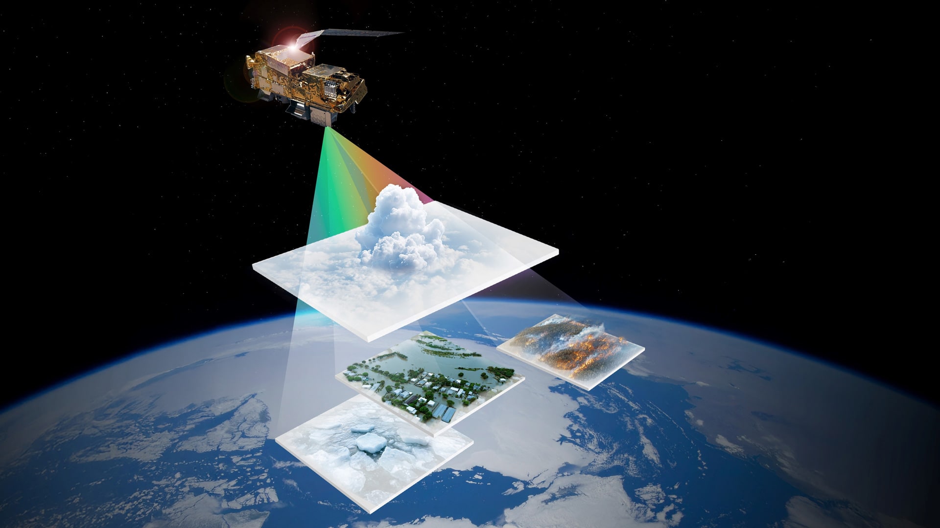
German Satellite's Multispectral Camera Improves Weather Forecasting Data
The German Space Agency is planning the launch of the Metop-SGA1 satellite of the European Organization for the Exploitation of Meteorological Satellites (EUMETSAT) for lift off from Kourou, French Guiana, on an Ariane 6 rocket, to occur on August 13, 2025.
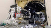
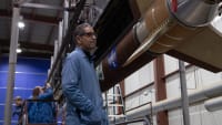
The instruments on board the Metop-SGA1 satellite will include the METimage multispectral camera, which will significantly improve weather forecasting in Europe and around the globe. The design and construction of the instrument were coordinated by the German Space Agency at DLR (Deutsches Zentrum für Luft- und Raumfahrt; the German Aerospace Center) and financed by the German Federal Ministry of Transport (BMV) and EUMETSAT. The German Weather Service (DWD) supported the preparation of the mission by providing advice and in particular formulating requirements for weather forecasting and climate monitoring. METimage was developed and built by Airbus Defense and Space at their manufacturing facility in Germany.
Highly Accurate Weather Forecasts Thanks to Satellite Data
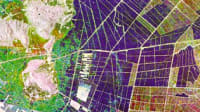
Satellite observations are a cornerstone of weather forecasting. They provide precise, comprehensive data from regions of Earth that are inadequately or not at all covered by other instruments. Together with other observations, this data helps to determine the current state of the atmosphere as accurately as possible. On this basis, numerical models calculate how the weather will develop over the coming hours and days. The Metop-SG satellite series will significantly improve overall weather forecasting, but especially the upcoming two to six hours. Known as 'nowcasting', this is crucial for warning of extreme events, as in many cases the extent and consequences of such events cannot be predicted using long-term weather models. Metop-SGA1 with the METimage instrument – and the other second-generation Metop-SG satellites – will make a crucial contribution to nowcasting from polar orbit.
"Warning people of extreme weather events as early as possible is enormously important for public safety," says Patrick Schnieder, Federal Minister of Transport. "That's why, together with EUMETSAT, we are funding the METimage multispectral camera. By contributing this cutting-edge technology, Germany is setting new standards in precise climate observation and weather forecasting. METimage will improve weather forecasting not only in Europe but worldwide, enabling policymakers, public authorities and industry to obtain information about potential extreme weather events even earlier and initiate appropriate responses."
"The number of extreme weather events is increasing significantly," says Walther Pelzer, DLR Executive Board Member and Director General of the German Space Agency at DLR. "If we are to take timely measures to protect ourselves and our infrastructure, we need precise weather information. Our everyday weather forecasting is largely based on satellite data. Thanks to its high spatial resolution, METimage will make a key contribution towards improving forecast quality. Its spectral camera measurements will also provide essential data for global climate models and help us take the right action to combat the effects of climate change."
"The modernized and expanded instrumentation on board Metop-SGA1 will help us improve both our forecasts and the accuracy of our warnings, not least through the use of cutting-edge AI-based applications," says Sarah C. Jones, President of the German Weather Service (DWD). "The satellite's potential lies particularly in improving weather forecasting through expanded observational data for data assimilation. Metop-SGA1 also opens up opportunities for a more detailed look at clouds – examining their height, composition and droplet size. With the new data, we can evaluate how well clouds are represented in our existing forecast models and develop them accordingly. Metop-SGA1 data also has great potential for in-depth analysis, improving our understanding of the Earth system and helping us develop our climate models – the results of which will form the basis for national and municipal adaptation strategies."

Long-Term Commitment to Global Weather Monitoring
Metop-SGA1 is part of the EUMETSAT Polar System – Second Generation (EPS-SG), Europe's contribution to the system of polar-orbiting meteorological satellites jointly maintained with the United States. EUMETSAT is responsible for the 'mid-morning' orbit, which crosses the equator at 09:30 local time.
The Metop-SG programme comprises six satellites: three consecutive pairs of A and B satellites carrying a variety of different but complementary instruments. The Metop-SG A satellites carry instruments for atmospheric sounding and imaging, while the B satellites carry instruments for microwave imaging and radar observations. Together they will ensure the continuity of the vital Metop data series until the mid-2040s. Metop-SG A satellites also carry the European Copernicus Sentinel-5 mission, built by Airbus and equipped with ultraviolet, visible, near-infrared and short-wave-infrared sensors for detailed measurements of atmospheric composition and trace gases.
The nominal operating life planned for the Metop-SG satellite series is 21 years, which will be covered by three identical satellite generations.
German Technology for European Meteorology
METimage hardware was developed, built and tested by Airbus Defence and Space together with more than 50 subcontractors. In addition to the first METimage model, which is now set to launch and is valued at approximately 300 million euros, two further flight models are currently in production. These are scheduled to launch on the Metop-SGA2 and A3 satellites in 2032 and 2039 respectively, to provide continuous weather data through the late 2040s.
More From SAE Media Group
Aerospace Manufacturing and Machining INSIDER
Ball Aerospace Starts Final Assembly of Space Force's Next Generation Operational Weather Satellite
Aerospace & Defense Tech Briefs
Ultraviolet Detector
NASA Spinoff
Aqua Solutions for Terra Firma
Aerospace & Defense Tech Briefs
Satellite Paves the Way for Improved Storm Tracking


Aerospace INSIDER
Boeing to Develop New Space Force Nuclear Communications Satellites

Aerospace & Defense Tech Briefs
SpaceRAN Demonstrator Will Test 5G Connectivity on Software-Defined Satellite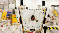
Aerospace & Defense Tech Briefs
Army Completes Satellite as a Managed Service Research Project
Aerospace INSIDER
Leonardo to Design Next Generation Atomic Clock for Galileo Satellites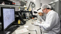

Tech Briefs INSIDER
NASA Measures Raindrop Sizes from Space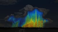
Aerospace INSIDER
Boeing's New Approach to 3D Printing Solar Arrays for Satellites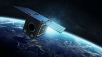
NASA Spinoff
Weather Forecasters Adopt NASA’s ‘Occult’ Science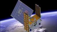

NASA Spinoff
Make Way for Satellites
Tech Briefs
7 Space Sustainability Startups
Aerospace & Defense Tech Briefs
Breakthrough in Long-Haul Laser Communication Capabilities
Aerospace & Defense Tech Briefs
Subjective Mapping of Dust-Emission Sources by Using MODIS Imagery
Tech Briefs
Measuring Soil Moisture for Global Maps

Aerospace Manufacturing and Machining INSIDER
Airbus Developing New Laser Communication Terminal for Military Aircraft
Top Stories
NewsAutomotive
![]() Microvision Aquires Luminar, Plans Relationship Restoration, Multi-industry Push
Microvision Aquires Luminar, Plans Relationship Restoration, Multi-industry Push
INSIDERManned Systems
![]() A Next Generation Helmet System for Navy Pilots
A Next Generation Helmet System for Navy Pilots
INSIDERManufacturing & Prototyping
![]() New Raytheon and Lockheed Martin Agreements Expand Missile Defense Production
New Raytheon and Lockheed Martin Agreements Expand Missile Defense Production
NewsAutomotive
![]() Ford Announces 48-Volt Architecture for Future Electric Truck
Ford Announces 48-Volt Architecture for Future Electric Truck
INSIDERAerospace
![]() Active Strake System Cuts Cruise Drag, Boosts Flight Efficiency
Active Strake System Cuts Cruise Drag, Boosts Flight Efficiency
ArticlesAR/AI
Webcasts
Electronics & Computers
![]() Cooling a New Generation of Aerospace and Defense Embedded...
Cooling a New Generation of Aerospace and Defense Embedded...
Power
![]() Battery Abuse Testing: Pushing to Failure
Battery Abuse Testing: Pushing to Failure
Communications
![]() A FREE Two-Day Event Dedicated to Connected Mobility
A FREE Two-Day Event Dedicated to Connected Mobility
Transportation
![]() Quiet, Please: NVH Improvement Opportunities in the Early Design Cycle
Quiet, Please: NVH Improvement Opportunities in the Early Design Cycle
Transportation
![]() Advantages of Smart Power Distribution Unit Design for Automotive &...
Advantages of Smart Power Distribution Unit Design for Automotive &...
Unmanned Systems
![]() Sesame Solar's Nanogrid Tech Promises Major Gains in Drone Endurance
Sesame Solar's Nanogrid Tech Promises Major Gains in Drone Endurance