


Regulation and Technology Changes Needed for Drone Detection, Mitigation in US Airspace

Drone operators, public safety organizations and government agencies need better regulatory coordination and an updated technological for detecting, mitigating and overall regulating the use of uncrewed aerial systems (UAS) in U.S. airspace. A recent U.S. Senate hearing, comments made by acting FAA Administrator Chris Roucheleau during the 2025 AUVSI Xponential event and ongoing incidents in U.S. airspace confirm this.
To its credit, the Federal Aviation Administration (FAA) has been actively researching the use of different types of drone detecting and mitigation technologies in recent years. However, the lack of coordinated detection and mitigation methods between federal, state and local government agencies are allowing rogue drones to impact commercial air traffic and public safety.
AUVSI President and CEO Michael Robbins directly addressed the need for change during his opening keynote speech at XPONENTIAL 2025. While discussing the FAA's progress with its long awaited 2209 rule on beyond visual line of sight (BVLOS) UAS operations, Robbins said more needs to be done.
"Increasingly, drone security and enabling regulations are being closely tied together. Accordingly, UAS Detection and Mitigation authorities must be updated and expanded. The last update was in 2018 – an unacceptable timeframe for a rapidly transforming landscape," Robbins said.
Based on the latest available data from the FAA, there are more than 1 million drones under commercial or recreational registration in the U.S. The agency expects that number to continue to grow, and primarily relies on Remote ID module broadcasts to track the positions of registered drones. That tracking however does not apply to unregistered rogue drones that police departments and other agencies routinely receive reports about in low altitude airspace.
The FAA's final rule on Remote ID became effective for UAS pilots in March 2024. However, according to an update on drone detection and mitigation in U.S. airspace published by AUVSI in March, Remote ID compliance is low.
“Remote ID compliance is below 50 percent. Houston, we have a problem. Clearly, some things need to change,” Robbins said during his keynote address.
While AUVSI is a major advocate for expanding commercial and civilian drone innovation and operations, the organization is also one of the largest voices advocating for changes to the current state of regulating drone operations in low altitude airspace. In March, Robbins published a blog article on AUVSI’s website outlining all of the changes needed for a more streamlined approach to detecting and mitigating rogue drones in low altitude airspace.
Currently, four federal agencies, DoD, DHS, DOE, and DOJ, are authorized to detect and mitigate UAS in U.S. airspace. That authority is limited, and AUVSI and other drone advocacy groups like the Commercial Drone Alliance have been stating the need for that authority to be expanded to other federal, state and local public safety agencies.
"Last December, the media and social media environment helpfully reminded us of that when 'drones over New Jersey' became a top trending story. The frenzy not only exposed the gaps in our nation’s low altitude airspace awareness but also showcased that public trust can evaporate quickly in the face of a crisis – real, imagined, misidentified, or contrived," Robbins said.
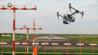
The FAA's latest efforts to improve the detection of un-regulated drone operations occurred during testing conducted by their Center of Excellence for UAS Research (ASSURE) in Cape May, New Jersey, between April 14-25. During the two week period, the agency operated more than 100 different home-built and commercial drones while evaluating the ability of different types of drone detection equipment to track them.
A brief video published by the FAA about the two week trial notes that the technology they evaluated was successful in detecting and identifying all of the drones they operated. One of the companies that participated in the trial was Robin Radar Systems with its 3D drone detection radar, IRIS. The system uses Frequency Modulated Continuous Wave (FMCW) radar to track the real-time position, altitude, speed and other parameters of drones flying at speeds of up to 60 mph.
The FAA has also tested drone detection technology supplied by D-Fend Solutions to detect drones flying near airports in recent years. Numerous other drone detection and surveillance technologies exist, including a pocket-sized portable drone tracking system that has been gaining tracking with public agencies developed by Czech Republic-based startup Dronetag. New Jersey-based AeroDefense has also developed a system called AirWarden Essentials that uses cloud computing services and a small receiver to monitor drone traffic using networked Remote ID broadcasts. The Department of Defense has also expressed interest in using AeroDefense's technology.

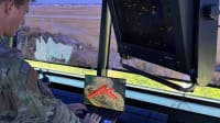
During his Q&A with AUVSI's Robbins at Xponential, the acting FAA Administrator Roucheleau said the agency still has not identified a drone detection system that it will permanently use moving forward.
"We want to make sure whether it's our defense counterparts, or Homeland Security, local and state law enforcement, those types, that they have the tools they need to identify those drones and to interdict those, certainly where they can. I will tell you that we have over 100 reports of drones next to airports, every month," Roucheleau said. "At the same time, what we've also learned is that mitigation equipment can be destructive to the airspace. We have had airport — including Denver, Dallas and DC — incidents where mitigation equipment has interfered with aviation operations."
One of the main issues related to drone detection and mitigation in low altitude airspace is the lack of authority given to police departments and other agencies that are directly dealing with rogue drones. Testimony given by Troy Wilson, Staff Captain for the Texas Department of Safety (DPS) during a hearing on drone detection held by the U.S. Senate Committee on the Judiciary provides perspective on this.
According to Wilson's opening statement, Texas DPS is one of several agencies responsible for security along the 1,254-mile Texas-Mexico Border. Their current main source of drone detection includes the use of 12 sensors that only detect DJI drones for approximately 180 miles of the border. Wilson said his agency has witnessed and arrested individuals for operating drones that provide them surveillance of border security personnel operations, and to coordinate the movement of contraband.
"Over the past twelve months (April 2024 to April 2025), Texas DPS-owned sensors identified 1,216 UAS border incursions. We know this is a fraction of the actual number of incidents. Alarmingly, nearly half of these UAS incursions occurred at altitudes ranging between 600 to 1,800 feet Above Ground Level (AGL) — the typical altitude range for helicopter operations," Wilson said.
Wilson's advocacy for more training and coordinated responses by agencies at the federal, state and local levels were shared by testimony given during the same Senate hearing by Seargeant Robert Dooley, the Statewide UAS/C-UAS Coordinator for the Florida Highway Patrol. His testimony also focused on the risks rogue drones present to aircraft and helicopters operated by public safety agencies in low altitude airspace.
"Most recently, we had a horrific car crash, where the (emergency) helicopter service that comes and transports patients couldn't take off because there was a rogue drone hovering over the helicopter and it created a huge hazard," Dooley said. "Public safety agencies must be able to detect, identify, and if authorized, mitigate UAS threats in real time. Without this capacity, agencies operate blindly in a shared airspace, increasing risks to both responders and the public."
Dooley also referenced the drone that struck a firefighting aircraft operated by the Government of Quebec that was providing aerial response to the wildfires that occurred throughout areas of Southern California in January. The drone strike caused a 3-inch-by-6inch hole in the left wing of the aircraft, causing more than $65,000 in damage.
D-Fend Solutions, one of the C-UAS technology providers that has participated in an FAA research program for detecting drones near airports, features a real-time tracker of drone incidents that occur globally on its website. Some of their most recent incidents featured in the tracker include the crash-landing of an Amazon delivery drone at a residential apartment complex in Arizona, and an unauthorized drone that was flown into Comerica Park for approximately 30 minutes during the opening day home game of the Detroit Tigers in April. Most of the other U.S.-based incidents in the tracker involve drones attempting to deliver items into prisons and correctional institutions.
More From SAE Media Group
Aerospace & Defense Tech Briefs
Low Cost Air Traffic Control for Drones
Aerospace INSIDER
MQ-1C Completes First Air-Launched Effect Flight Demonstration
Aerospace & Defense Tech Briefs
In Pursuit of Networked Drone Operations
Aerospace INSIDER
VSR700 Unmanned Helicopter Performs Autonomous Flight Testing with DGA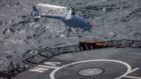
Aerospace & Defense Tech Briefs
Autonomous Collaborative Platform
Aerospace INSIDER
EASA Ready to Adopt Final Regulations for eVTOL Operations

Aerospace INSIDER
NASA UAV Flies Alone in Public Airspace
Tech Briefs
Integrating UAS into Next-Generation Systems
Tech Briefs
AUSA 2024: New Drones and Counter UAS Technology
Aerospace INSIDER
NASA Tests Could Lead to FAA Integration of UAVs
Aerospace INSIDER
BAE Systems Acquires Developer of Electric Heavy Lift Quadcopters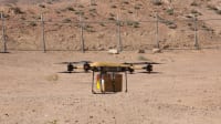
Aerospace INSIDER
FAA to Replace Aging Network of Ground-Based Radars
Aerospace & Defense Tech Briefs
Enabling Off-the-Shelf Autonomous Naval Warfare
NASA Spinoff
NASA Helps Drones Take Flight
Aerospace & Defense Tech Briefs
Unmanned Aircraft Systems Help Responders in Urban Environments

Aerospace INSIDER
Unmanned "Urban Beat Cop" Surveillance System Protects Soldiers

Motion Design INSIDER
AI-Powered Vision System Helps Drones Navigate Safely
NASA Spinoff
Technologies Advance UAVs for Science, Military
Aerospace INSIDER
Two Startups Partner to Expand Hydrogen-Powered Drone Production
Top Stories
INSIDERDefense
![]() New Raytheon and Lockheed Martin Agreements Expand Missile Defense Production
New Raytheon and Lockheed Martin Agreements Expand Missile Defense Production
NewsAutomotive
![]() Ford Announces 48-Volt Architecture for Future Electric Truck
Ford Announces 48-Volt Architecture for Future Electric Truck
INSIDERAerospace
![]() Active Strake System Cuts Cruise Drag, Boosts Flight Efficiency
Active Strake System Cuts Cruise Drag, Boosts Flight Efficiency
ArticlesAR/AI
![]() Accelerating Down the Road to Autonomy
Accelerating Down the Road to Autonomy
INSIDERManned Systems
![]() How Airbus is Using w-DED to 3D Print Larger Titanium Airplane Parts
How Airbus is Using w-DED to 3D Print Larger Titanium Airplane Parts
Road ReadyDesign
Webcasts
Power
![]() Battery Abuse Testing: Pushing to Failure
Battery Abuse Testing: Pushing to Failure
Power
![]() A FREE Two-Day Event Dedicated to Connected Mobility
A FREE Two-Day Event Dedicated to Connected Mobility
Power
![]() 2026 Battery & Electrification Summit (Online)
2026 Battery & Electrification Summit (Online)
Software
![]() Smarter Aerospace Manufacturing & Design with Digital Twins and...
Smarter Aerospace Manufacturing & Design with Digital Twins and...
Aerospace
![]() Cooling a New Generation of Aerospace and Defense Embedded Computing...
Cooling a New Generation of Aerospace and Defense Embedded Computing...
Transportation
![]() Quiet, Please: NVH Improvement Opportunities in the Early Design Cycle
Quiet, Please: NVH Improvement Opportunities in the Early Design Cycle