


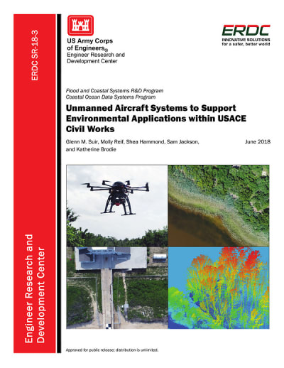
Unmanned Aircraft Systems to Support Environmental Applications within USACE Civil Works
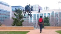
The U.S. Army Corps of Engineers (USACE) has identified a number of research and development (R&D) opportunities to help reduce disaster risks, including cost-efficient technology, such as unmanned aircraft system (UAS) technology for accurate, detailed, and timely two-dimensional and three-dimensional monitoring of coastal and riverine landscapes.
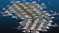
Coastal and riverine shorelines are dynamic landscapes that change continually in response to environmental forces. The combination of static infrastructure with dynamic and diverse landscapes creates management challenges for navigation, storm damage reduction, and ecosystem health that are exacerbated during natural disasters. The U.S. Army Corps of Engineers (USACE) flood risk management (FRM) mission strives to reduce the nation's flood risk and increase resilience to disasters. FRM is inherently interdisciplinary, requiring accurate identification of environmental, physical, and infrastructure features that can reduce risk from flood and coastal storm disasters.
USACE has identified a number of research and development (R&D) opportunities that will help reduce disaster risks, including: identifying better technologies for hazard identification pre- and post-events; developing an interdisciplinary understanding of physical, chemical, and biological recovery processes that occur post-event; and providing shared and easily accessible, up-to-date data sets that can be utilized by flood and coastal storm modeling and predictive tools to inform emergency response.
Cost-efficient technology and methodology, such as the use of unmanned aircraft system (UAS) technology for accurate, detailed, and timely two-dimensional (2D) and three-dimensional (3D) monitoring of coastal and riverine landscapes, have the potential to address many of these goals. However, an important process in adapting new technologies is ensuring an understanding of existing methods, identifying gaps or shortcomings with current techniques, and then developing new approaches and providing guidance and insight on how new tools can address these gaps, as well as exploring potential future capabilities. To that end, the USACE Flood and Coastal Systems R&D Program (FCS) has initiated an effort focused on identifying and developing defendable and consistent UAS-based methodologies and data products that can seamlessly integrate with numerical models to improve quantification of the nation's flood risks to coastal and riverine shorelines, infrastructure, ecosystems, and communities.
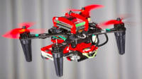
Remotely sensed data provide spatial and temporal perspectives on ecological phenomena that would otherwise be difficult to study. Though traditional air- and space-borne systems provide many advantages, they are often constrained by cost; temporal, spatial, and spectral resolution; and cloud contamination. UASs are emerging as flexible platforms that, in many cases, overcome previous constraints and, therefore, have the potential to supplement or replace measurements acquired from other methods.
Major advantages of UASs can be found in the ability to operate in high-risk situations, in inaccessible areas, at low altitudes, and close to targets, all without endangering human life. Recent technological advances in UASs, including the miniaturization of components and improvements in electronics, navigation, and telemetry, have resulted in reduced costs and risks, increased efficiencies, and enhanced products and perspectives on projects. These UAS improvements have resulted in a growing service mechanism with widespread application across civil, military, and public sector uses.
Though remote sensing is not new to the USACE, advanced techniques have transformed ecological research by providing unique spatial and temporal perspectives on ecological phenomena and offer the potential for much higher resolution data at more frequent intervals, enabling scientists to more consistently examine a range of ecological systems. Environmental monitoring, especially to evaluate the success of large-or small-scale restoration projects, requires the ability to detect and map land surface attributes and landscape level characteristics over time and space.
The most practical method for these assessments is through high spatial resolution imagery (< 5 meter (m) spatial resolution), either from satellite or airborne platforms. Airborne systems have traditionally been considered the most available, versatile, and widely used means of acquiring remotely sensed data products. For decades, these data sources and products have been routinely used within the USACE for environmental mapping applications.
This work was done by Glenn M. Suir, Molly Reif, Shea Hammond, Sam Jackson, and Katherine Brodie for the Army Engineer Research and Development Center. For more information, download the Technical Support Package (free white paper) from the link below. ERDC-0013
This Brief includes a Technical Support Package (TSP).
Unmanned Aircraft Systems to Support Environmental Applications within USACE Civil Works
(reference ERDC-0013) is currently available for download from the TSP library.
Don't have an account?
More From SAE Media Group
Aerospace & Defense Tech Briefs
Solar Powering UAVs
Tech Briefs
Testing Swarming Drones
Aerospace & Defense Tech Briefs
Agile Robust Autonomy: Inspired by Connecting Natural Flight and Biological Sensors
Aerospace & Defense Tech Briefs
Defeating Commercial Drone Threats with Software Defined Radio
Aerospace & Defense Tech Briefs
Validation of Architecture Models for Coordination of Unmanned Air and Ground Vehicles via Experimentation
Aerospace & Defense Tech Briefs
Playing Defense — Uncertain Regulations Stall the Implementation of Counter-UAS Technology in The U.S.
Tech Briefs
Approach Makes Unmanned Agents Self-Sufficient
Aerospace & Defense Tech Briefs
Ground Control System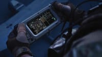
Tech Briefs
System Helps Drones Detect and Avoid Power Lines

Tech Briefs
Algorithms Improve Quadrotor Drone Performance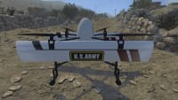

Aerospace & Defense Tech Briefs
Cyber Risk Assessment and Scoring Model for Small Unmanned Aerial Vehicles
Aerospace & Defense Tech Briefs
Improving Low-Altitude UAS Navigation
Robotics & Automation INSIDER
A New Home for Sustainability Robotics
Aerospace & Defense Tech Briefs
Optimal UAS Assignments and Trajectories for Persistent Surveillance and Data Collection from a Wireless Sensor Network
Aerospace & Defense Tech Briefs
Connectors Lighten the SWaP Burden in UAV/MUMT Aircraft Electronics
Aerospace & Defense Tech Briefs
Drone Swarms: A Transformational Technology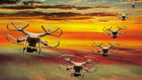


Tech Briefs
Keeping Drones Flying When a Motor Fails
Aerospace & Defense Tech Briefs
One Person Can Supervise a Swarm of 100 Unmanned Autonomous Vehicles
Aerospace & Defense Tech Briefs
Assessment of Noncommercial Icing Prediction Capabilities for Army Applications
Tech Briefs
Drones Use Machine Learning to Detect Landmines
Aerospace & Defense Tech Briefs
A Simpler Method for Learning to Control a Robot
Tech Briefs
Drones Change Shape Mid-Flight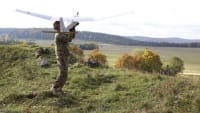
Aerospace & Defense Tech Briefs
Characterizing Motion Prediction in Small Autonomous Swarms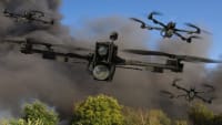
Overview
The document titled "Unmanned Aircraft Systems to Support Environmental Applications within USACE Civil Works" focuses on the integration of Unmanned Aircraft Systems (UAS) technology into the operations of the U.S. Army Corps of Engineers (USACE), particularly in environmental missions and flood risk management. It emphasizes the potential of UAS to enhance data collection and monitoring practices, providing timely and accurate information critical for managing coastal and riverine landscapes.
The report outlines the advantages of UAS technology, including its ability to operate in high-risk and inaccessible areas, low-altitude flight capabilities, and the collection of high-resolution data without endangering human life. UAS can supplement traditional air- and space-borne systems, which often face limitations related to cost, resolution, and environmental conditions. The document highlights the growing interest in UAS technology across various USACE districts, noting that it can lead to significant cost and time savings compared to conventional contracting methods.
Feedback from various USACE districts indicates a strong interest in UAS applications for environmental monitoring, including vegetation mapping, topographic surveys, and real-time inspections. The report also discusses the need for policy development to facilitate the broader adoption of UAS technology within USACE operations. It identifies several research and development opportunities aimed at creating consistent methodologies and data products that align with USACE's flood risk management goals.
The document emphasizes the importance of collaboration among USACE districts to share experiences and best practices related to UAS technology. It also notes the potential for UAS to improve situational awareness and enhance the accuracy of environmental assessments, which are crucial for effective decision-making in disaster risk reduction.
In conclusion, the report serves as a technical review of UAS capabilities and their application in environmental missions, advocating for the integration of this technology into USACE operations to improve efficiency, accuracy, and safety in managing flood risks and environmental challenges. The findings underscore the transformative potential of UAS in modernizing data collection and enhancing the effectiveness of USACE's civil works initiatives.
Top Stories
NewsSensors/Data Acquisition
![]() Microvision Aquires Luminar, Plans Relationship Restoration, Multi-industry Push
Microvision Aquires Luminar, Plans Relationship Restoration, Multi-industry Push
INSIDERRF & Microwave Electronics
![]() A Next Generation Helmet System for Navy Pilots
A Next Generation Helmet System for Navy Pilots
INSIDERWeapons Systems
![]() New Raytheon and Lockheed Martin Agreements Expand Missile Defense Production
New Raytheon and Lockheed Martin Agreements Expand Missile Defense Production
NewsAutomotive
![]() Ford Announces 48-Volt Architecture for Future Electric Truck
Ford Announces 48-Volt Architecture for Future Electric Truck
INSIDERAerospace
![]() Active Strake System Cuts Cruise Drag, Boosts Flight Efficiency
Active Strake System Cuts Cruise Drag, Boosts Flight Efficiency
ArticlesTransportation
Webcasts
Aerospace
![]() Cooling a New Generation of Aerospace and Defense Embedded...
Cooling a New Generation of Aerospace and Defense Embedded...
Energy
![]() Battery Abuse Testing: Pushing to Failure
Battery Abuse Testing: Pushing to Failure
Power
![]() A FREE Two-Day Event Dedicated to Connected Mobility
A FREE Two-Day Event Dedicated to Connected Mobility
Automotive
![]() Quiet, Please: NVH Improvement Opportunities in the Early Design Cycle
Quiet, Please: NVH Improvement Opportunities in the Early Design Cycle
Electronics & Computers
![]() Advantages of Smart Power Distribution Unit Design for Automotive &...
Advantages of Smart Power Distribution Unit Design for Automotive &...
Unmanned Systems
![]() Sesame Solar's Nanogrid Tech Promises Major Gains in Drone Endurance
Sesame Solar's Nanogrid Tech Promises Major Gains in Drone Endurance