


Geo*View
General-purpose imagery viewer supports a variety of visualization requirements for government and commercial applications.
Visualization of geospatially correct, remotely sensed data is a key element of many government and commercial applications. It enables a user to analyze and assess ground activities and other conditions of interest. Because remotely sensed data can include a diversity of data types reflecting many different data formats, users may experience difficulty visualizing and interpreting these varying data types and formats due to data structure complexity. In addition, important supplemental information often accompanies the data. This supplemental information—or metadata— may include pertinent information of significant value to the user with respect to where, when, and how data collection occurred. Whereas some applications require metadata to support geospatial analysis functions such as positioning and measurement, many others are unable to interpret such metadata and it may thus go unnoticed. Multiband data and motion imagery further compound the task of visualization with spectral components and complex video streams interlaced with other geospatial information.
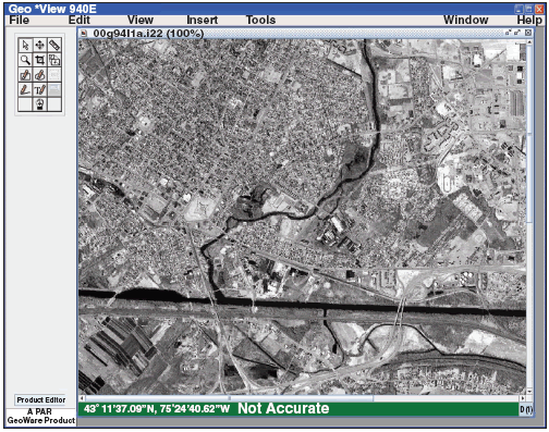
AFRL, in collaboration with PAR Government Systems Corporation, developed Geo*View, a general-purpose, easy-to-use, point-and-click-oriented imagery viewer that supports a variety of visualization requirements for government and commercial remote sensing applications (see Figure 1). Geo*View is a Java™-based, platform-independent, self-installing application with a plug-in architecture designed for timely integration of remote sensing, geospatial, and image exploitation algorithms. The viewer supports commercial imagery, multi-hyperspectral imagery, Moving Picture Experts Group (MPEG)-2 video, standard mapping and geospatial products, and Department of Defense (DoD) imagery formats. Hyperspectral aids provide automated band selection, plug-ins for anomaly detection, and spectral-matched filtering. Other developmental features include a local spectral signature library, band reduction and aggregation functions, and pixel classification.
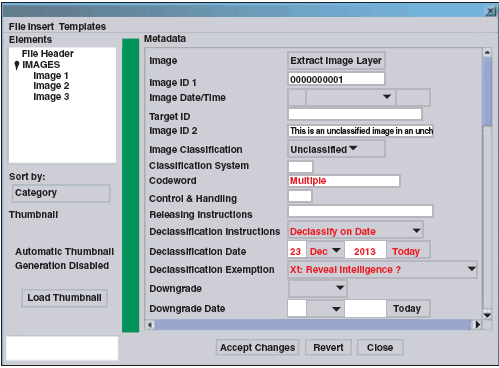
Motion imagery support provides basic controls for video play, pause, and frame advance. Frame-based MPEG-2 video multiplexing/demultiplexing and metadata decoding are available for parsing out geolocation information. The viewer also features basic operations for tracking and annotating objects, building video mosaics, and clipping out frames. Geo*View is National Imagery Transmission Format (NITF) 2.1-certified to complexity level 7 for reading and writing. It autopopulates and validates the NITF geospatial metadata and supplies an NITF metadata editor for updating and regenerating NITF-compliant data files (see Figure 2).
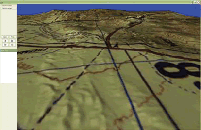
Reusable software toolkit libraries for mapping and three-dimensional (3-D) visualization provide capabilities that can interact with Geo*View or be integrated into other viewing applications. Operators can configure the mapping toolkit to act as a map-based query function or a viewable canvas for layering maps, imagery, graphics, and shape files in a common geospatial reference. They can also use the 3-D visualization toolkit to load, display, and drape map data, imagery, and video over digital terrain elevation data to create a 3-D representation of a region of interest, which they can then manipulate to change the viewing perspective (see Figure 3). AFRL has distributed Geo*View to numerous government agencies and users and affiliated developers for on-site use and integration with other DoD systems and capabilities.
Mr. Frederick W. Rahrig, of the Air Force Research Laboratory's Information Directorate, wrote this article. For more information, contact TECH CONNECT at (800) 203-6451 or place a request at http://www.afrl.af.mil/techconn/index.htm . Reference document IF-H-05-10.
More From SAE Media Group
Automotive Engineering
Ford Releasing Comprehensive Dataset to Promote Autonomous R&D
Off-Highway Engineering
AI Moves into Military Boards and Subsystems
Off-Highway Engineering
Deere’s Ingredients for Innovation
Tech Briefs
Computer Vision App for Monitoring Diabetes
Off-Highway Engineering
CrossControl Advances Virtual Fencing and Object Detection
Automotive Engineering
Alitheon’s Vision Is Easy Digital Traceability
Motion Design
Guiding the Way in Automotive Plants
Aerospace & Defense Tech Briefs
Development and Verification of Body Armor Target Geometry Created Using Computed Tomography Scans
Photonics & Imaging Technology
Novel Techniques Trick Object Detection Systems
Autonomous Vehicle Engineering
A Legal Profile of Facial Recognition
Medical Design Briefs
Spatially-Invariant Vector Quantization for Image Analysis
Photonics & Imaging Technology
Detecting Threats Beyond the Limits of Human, Sensor Sight
Tech Briefs
Crew Activity Analyzer
Tech Briefs
Method for Tracking Moving Targets
Automotive Engineering
Snapdragon Ride Flex Puts Safety, Infotainment onto Single Chip

Tech Briefs
Product of the Month
Photonics & Imaging Technology
Artificial Intelligence Magnifies the Utility of Electron Microscopes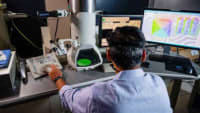
Sensing Technology
New App Performs Real-Time, Full-Body Motion Capture With a Mobile Device
Tech Briefs
Fused Analytic Desktop Environment (FADE)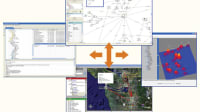

Tech Briefs
Estimated Spectrum Adaptive Postfilter (ESAP)
Tech Briefs
New Tech: See No Data, Steal No Data
Photonics & Imaging Technology
Calibration Method Improves Scientific Research Performed with Smartphone Cameras
Automotive Engineering
Ultra-Wide, Low-Distortion Lenses for Crash Testing Environments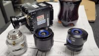


Top Stories
NewsRF & Microwave Electronics
![]() Microvision Aquires Luminar, Plans Relationship Restoration, Multi-industry Push
Microvision Aquires Luminar, Plans Relationship Restoration, Multi-industry Push
INSIDERAerospace
![]() A Next Generation Helmet System for Navy Pilots
A Next Generation Helmet System for Navy Pilots
INSIDERDesign
![]() New Raytheon and Lockheed Martin Agreements Expand Missile Defense Production
New Raytheon and Lockheed Martin Agreements Expand Missile Defense Production
INSIDERMaterials
![]() How Airbus is Using w-DED to 3D Print Larger Titanium Airplane Parts
How Airbus is Using w-DED to 3D Print Larger Titanium Airplane Parts
NewsPower
![]() Ford Announces 48-Volt Architecture for Future Electric Truck
Ford Announces 48-Volt Architecture for Future Electric Truck
ArticlesAR/AI
Webcasts
Electronics & Computers
![]() Cooling a New Generation of Aerospace and Defense Embedded...
Cooling a New Generation of Aerospace and Defense Embedded...
Automotive
![]() Battery Abuse Testing: Pushing to Failure
Battery Abuse Testing: Pushing to Failure
Power
![]() A FREE Two-Day Event Dedicated to Connected Mobility
A FREE Two-Day Event Dedicated to Connected Mobility
Unmanned Systems
![]() Quiet, Please: NVH Improvement Opportunities in the Early Design Cycle
Quiet, Please: NVH Improvement Opportunities in the Early Design Cycle
Automotive
![]() Advantages of Smart Power Distribution Unit Design for Automotive &...
Advantages of Smart Power Distribution Unit Design for Automotive &...
Energy
![]() Sesame Solar's Nanogrid Tech Promises Major Gains in Drone Endurance
Sesame Solar's Nanogrid Tech Promises Major Gains in Drone Endurance