
Mapping Canada — Centimeter by Centimeter
A Montreal-based company leverages artificial intelligence to take on the task of developing high-definition maps of Canada.
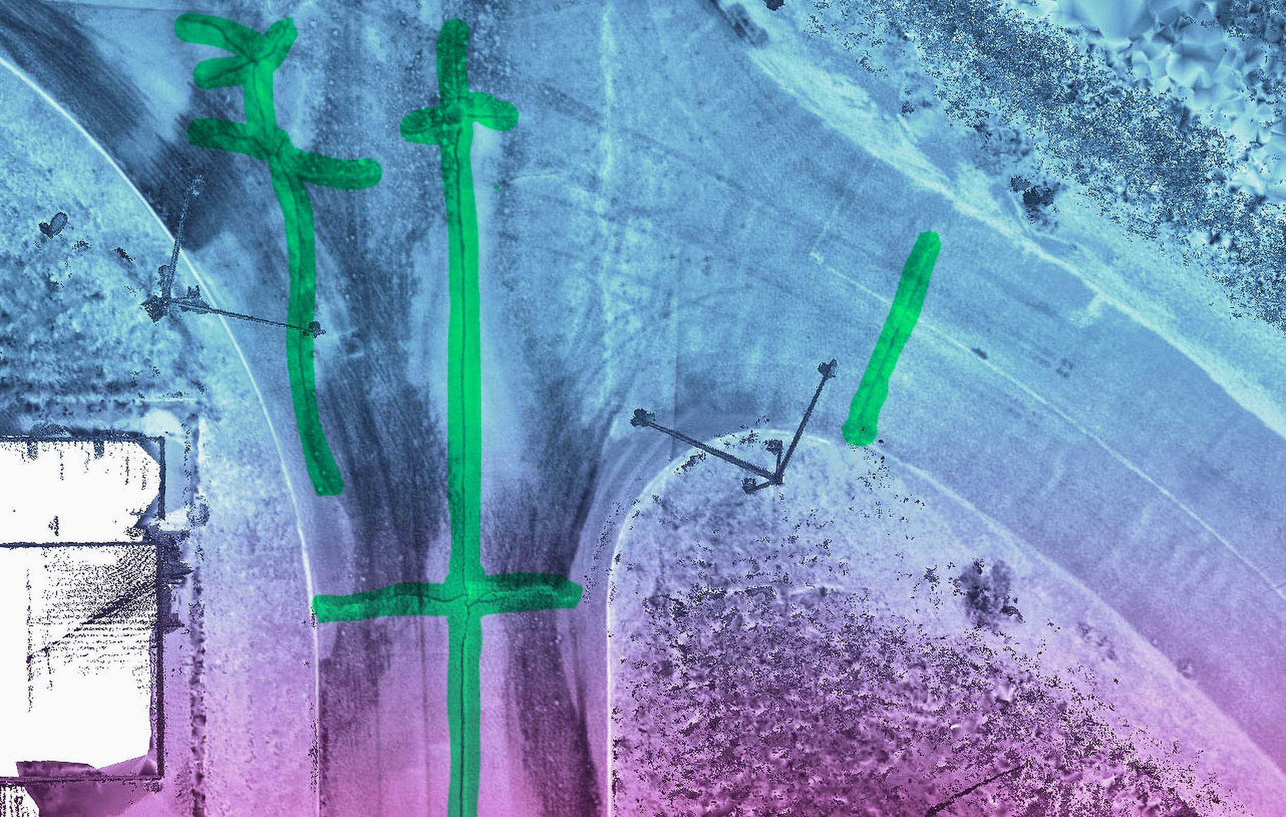
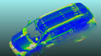
Fully-automated vehicles will only be as smart as the datasets they use to determine their driving pathways. Jakarto Cartographie 3D, a young company based in Montreal, is working on AI-powered, high-definition maps that it claims offer 2-3 cm (.787 to 1.2-inch) absolute precision and relative precision measured in millimeters. In other words, better maps that will allow for better automated vehicles (AVs).
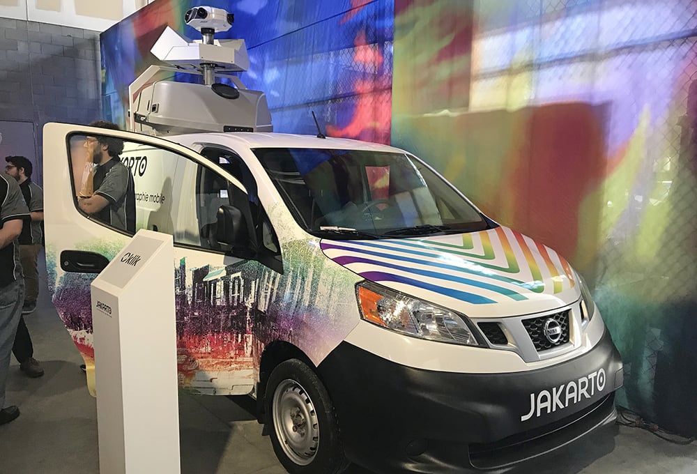
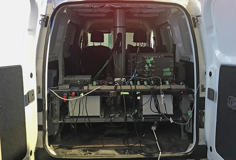
Started two years ago, Jakarto currently has three Nissan NV200 mapping vans equipped with a data collection unit that contains five cameras, a GPS unit and two ZF-supplied lidar sensors that each generate one million points per second. Jakarto calls the resulting maps RoadSkeleton, claiming they'll be beneficial for smart cities and AVs. As numerous Jakarto representatives said during the company's participation at the recent 2019 Michelin Movin'On sustainable-mobility summit in Montreal, RoadSkeleton is like "Google Street View on steroids."
RoadSkeleton can identify objects such as lampposts, manhole covers, traffic lights, signs and bridge height, but not to 100% accuracy just yet. That's because the in-house software still is in development phase. Jakarto developer Antoine Chaux said the HD maps will give the company a lot of advantages when it comes to supporting autonomous driving. A passenger car might not need to know much about height, but if you are in an automated cargo truck or recreational vehicle under a bridge, it's vital information, Chaux said.
Jakarto has mapped about 5000 km (3107 miles) of the Trans-Canada Highway between Montreal and Vancouver and another 1,000-2,000 km in Quebec, Chaux said. Of the company’s ten employees, about half are coders, three are drivers and the rest are executive staff. Chaux said the next six months will be dedicated to mapping more roads in Canada, as well as starting service in France. “To have a 3D map of the cities will be an interesting market,” he said.
Some AVs may already have maps generated by lidar, GPS and cameras, but Chaux said they may not be precise enough for some applications. Finding a parking space in a city, for example, might require knowing exactly how long and wide that space is and the size of your vehicle. “With our map, you can measure precisely the size of the parking space and you will know where your car can park,” he said, adding that a second service that identifies if the space is currently available obviously also will be required, since Jakarto would pass by the space and measure it only once or twice a year.
Chaux said that Jakarto's mapping sensors can precisely measure spaces even if they are visually blocked by, say, a parked vehicle. This is because the system measures the lines painted on the ground and gets multiple views of the space as the truck drives by. Currently, one of Jakarto's vans can in a day map around 200 kilometers (124 miles) on the highway or around 30 to 50 km (19 to 31 miles) in a city, because it needs to drive slower there.
Once collected, a day's worth of driving data requires three days to process, Chaux said. This will speed up as the company grows, he promised. "In the three days of processing, we have one whole day which is someone doing it manually," he said. "We're in the process of adding more AI and are targeting a fully-automatic system."
More From SAE Media Group
Autonomous Vehicle Engineering
Building Geofences to Speed AV Adoption
Automotive Engineering
Ford Releasing Comprehensive Dataset to Promote Autonomous R&D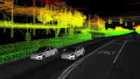
ADAS & Autonomous Vehicle Engineering
AV Life After Argo AI
Off-Highway Engineering
USPS Tests Autonomous Semi-Trailers for Long-Haul Mail Logistics
Autonomous Vehicle Engineering
Hopeful but Closer Scrutiny for SAE Level 4 Automation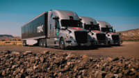
Automotive Engineering
Nvidia’s New Level 2+ Autonomy Platform Is Making Cars Safer Today
Autonomous Vehicle Engineering
BMW 7-Series Drives Itself Through Own Assembly
Autonomous Vehicle Engineering
New Roles for Lidar in Autonomy’s Lower Levels
Automotive Engineering
Nvidia Partners with AdaCore to Secure Self-Driving Firmware
Autonomous Vehicle Engineering
Sensing Enters a New Era
Autonomous Vehicle Engineering
The ‘Buzz’ in Driverless Shuttling
Off-Highway Engineering
ZF Advancing ADAS, Autonomy with Next-Gen Sensors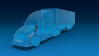

Autonomous Vehicle Engineering
Deere Touts Software, AI Tech at CES
Autonomous Vehicle Engineering
Continental's Lidar in a Flash
Off-Highway Engineering
Trucks with Intuition
Off-Highway Engineering
Autonomous Trucking Hits Rocky Road
Off-Highway Engineering
Peloton Develops a Level 4 Automated Platooning System, but Keeps the Driver in Charge
Off-Highway Engineering
WCX 2019: IAMTS Association Will Establish Standardization and Testing for Connected Vehicles
Off-Highway Engineering
Artificial Intelligence Being Schooled for Mining Applications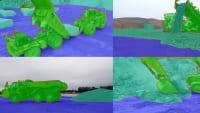
Autonomous Vehicle Engineering
Training Data-Hungry AI Algorithms
Autonomous Vehicle Engineering
Data Drives Driverless Truck Launch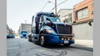
Off-Highway Engineering
Scalable Hardware-Software Interface Answers Overlooked AV Testing Need
Autonomous Vehicle Engineering
New Mobility’s Mega-Mappers
Autonomous Vehicle Engineering
The Navigator: Mapping the Way to Safe Automated Driving
Automotive Engineering
Volvo EX90 Uses AI, NVIDIA SoC to Make Automated Driving Safer
Automotive Engineering
MOIA’s L4 ID. Buzz AVs Starting Service Next Year

Off-Highway Engineering
Automating Machines for Off-Highway Environs Is Simple, Yet Difficult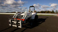
Top Stories
NewsRF & Microwave Electronics
![]() Microvision Aquires Luminar, Plans Relationship Restoration, Multi-industry Push
Microvision Aquires Luminar, Plans Relationship Restoration, Multi-industry Push
INSIDERAerospace
![]() A Next Generation Helmet System for Navy Pilots
A Next Generation Helmet System for Navy Pilots
INSIDERDesign
![]() New Raytheon and Lockheed Martin Agreements Expand Missile Defense Production
New Raytheon and Lockheed Martin Agreements Expand Missile Defense Production
INSIDERMaterials
![]() How Airbus is Using w-DED to 3D Print Larger Titanium Airplane Parts
How Airbus is Using w-DED to 3D Print Larger Titanium Airplane Parts
NewsPower
![]() Ford Announces 48-Volt Architecture for Future Electric Truck
Ford Announces 48-Volt Architecture for Future Electric Truck
ArticlesAR/AI
Webcasts
Electronics & Computers
![]() Cooling a New Generation of Aerospace and Defense Embedded...
Cooling a New Generation of Aerospace and Defense Embedded...
Automotive
![]() Battery Abuse Testing: Pushing to Failure
Battery Abuse Testing: Pushing to Failure
Power
![]() A FREE Two-Day Event Dedicated to Connected Mobility
A FREE Two-Day Event Dedicated to Connected Mobility
Unmanned Systems
![]() Quiet, Please: NVH Improvement Opportunities in the Early Design Cycle
Quiet, Please: NVH Improvement Opportunities in the Early Design Cycle
Automotive
![]() Advantages of Smart Power Distribution Unit Design for Automotive &...
Advantages of Smart Power Distribution Unit Design for Automotive &...
Energy
![]() Sesame Solar's Nanogrid Tech Promises Major Gains in Drone Endurance
Sesame Solar's Nanogrid Tech Promises Major Gains in Drone Endurance