


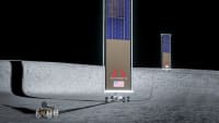
Image-Based Navigation Helps Spacecraft Land on The Moon

In order for future lunar exploration missions to be successful and land more precisely, engineers must equip spacecraft with technologies that allow them to “see” where they are and travel to where they need to be.
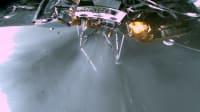
Engineers demonstrated how, with a sequence of images, they can determine the direction a spacecraft is moving. Those direction-of-motion measurements, combined with data from other spacecraft sensors and information that scientists already know about the Moon’s orientation, can be substituted into a series of mathematical relationships to help the spacecraft navigate.
More From SAE Media Group
Tech Briefs
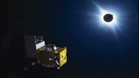
Commercial Lunar Landers Ready for the Moon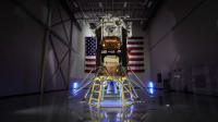

Tech Briefs
Humanity's Next Lunar Adventure Begins
Tech Briefs
Moon Missions: 5 Lunar Landers in 2025
Tech Briefs
NASA’s CADRE Rovers Prepare for Launch
Motion Design INSIDER
Precision Landing Without a Pilot


Tech Briefs
Testing AstroAnts for the IM2 Lunar Mission

Aerospace INSIDER
CubeSat to Help Guide Moon-Bound Spacecraft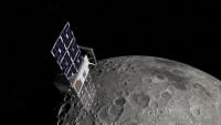

NASA Spinoff
Living Off Our Moon
Aerospace & Defense Tech Briefs
A Swarm of Sensors, Rovers and Astronauts Explore the ‘Moon’


Aerospace INSIDER
Blue Ghost Arrives in Lunar Orbit, Prepares for Landing
Aerospace INSIDER
Sensor Tests Moon Landing Technology
Tech Briefs
The Most Reliable Fluid Control in the Galaxy
Aerospace INSIDER
NASA CubeSats Head to Mars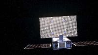
Aerospace Manufacturing and Machining INSIDER
Three Companies to Lead Development of Artemis Lunar Terrain Vehicles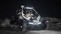
Aerospace INSIDER
Sticking the Landing on the Moon and Mars
Tech Briefs
Hard(ware) to the Core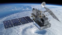
Tech Briefs
What’s the Future of Lunar Exploration?
Top Stories
INSIDERDefense
![]() New Raytheon and Lockheed Martin Agreements Expand Missile Defense Production
New Raytheon and Lockheed Martin Agreements Expand Missile Defense Production
NewsAutomotive
![]() Ford Announces 48-Volt Architecture for Future Electric Truck
Ford Announces 48-Volt Architecture for Future Electric Truck
INSIDERManufacturing & Prototyping
![]() Active Strake System Cuts Cruise Drag, Boosts Flight Efficiency
Active Strake System Cuts Cruise Drag, Boosts Flight Efficiency
ArticlesTransportation
![]() Accelerating Down the Road to Autonomy
Accelerating Down the Road to Autonomy
INSIDERMaterials
![]() How Airbus is Using w-DED to 3D Print Larger Titanium Airplane Parts
How Airbus is Using w-DED to 3D Print Larger Titanium Airplane Parts
Road ReadyTransportation
Webcasts
Electronics & Computers
![]() Cooling a New Generation of Aerospace and Defense Embedded...
Cooling a New Generation of Aerospace and Defense Embedded...
Power
![]() Battery Abuse Testing: Pushing to Failure
Battery Abuse Testing: Pushing to Failure
Connectivity
![]() A FREE Two-Day Event Dedicated to Connected Mobility
A FREE Two-Day Event Dedicated to Connected Mobility
Automotive
![]() Quiet, Please: NVH Improvement Opportunities in the Early Design Cycle
Quiet, Please: NVH Improvement Opportunities in the Early Design Cycle
Transportation
![]() Advantages of Smart Power Distribution Unit Design for Automotive &...
Advantages of Smart Power Distribution Unit Design for Automotive &...
Aerospace
![]() Sesame Solar's Nanogrid Tech Promises Major Gains in Drone Endurance
Sesame Solar's Nanogrid Tech Promises Major Gains in Drone Endurance