


NASA Data Aids California Wildfire Response

NASA’s Earth resources aircraft, as well as multiple satellites, are providing critical data to aid various agencies responding to the wildfires damaging vast areas of southern California. NASA operates two Lockheed ER-2 Earth resources aircraft as flying laboratories in the Sub-Orbital Science Program, collecting information on Earth resources, atmospheric chemistry and dynamics, and oceanic processes.
The Moderate Resolution Imaging Spectroradiometer (MODIS) on NASA’s Terra satellite acquired images of the largest of the blazes — the fast-moving Thomas fire in Ventura County – as well as the Creek and Rye fires.
More From SAE Media Group
Aerospace & Defense Tech Briefs
New Zealand and LeoLabs Establish the First Low-Earth Orbit Regulatory Platform
Tech Briefs
How Can the Private Sector Support Space?
Aerospace INSIDER
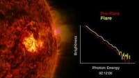
A Prototype Fuel Gauge for Orbit
Aerospace & Defense Tech Briefs
CAM Software

Tech Briefs
Occulter for CubeSat CoronagraphPhotonics & Imaging Technology INSIDER
NASA’s First Two-Way End-to-End Laser Communications Relay System


Aerospace INSIDER
Blue Ghost Arrives in Lunar Orbit, Prepares for Landing


NASA Spinoff
Separation Device Launches New Science Payloads
NASA Spinoff
Earth Images Enable Near-Perfect Crop Predictions
Aerospace & Defense Tech Briefs
Modeling Space-Based Intelligence, Surveillance, and Reconnaissance (ISR) in Combat Simulations
Automotive Engineering
OneWeb Ramps up Satellite Production with New Round of Funding
Tech Briefs
Better Data for Bodies in Motion
Aerospace INSIDER
Airbus Demonstrates Very High-Speed Optical Link Between Space and Earth
Photonics & Imaging Technology INSIDER
The James Webb Space Telescope Successfuly Launches
NASA Spinoff
Flash Lidar Enables Driverless Navigation


Photonics & Imaging Technology INSIDER
SoloHI Imager Captures Rare Shot of Venus, Earth, Mars, and Uranus
Top Stories
INSIDERManufacturing & Prototyping
![]() How Airbus is Using w-DED to 3D Print Larger Titanium Airplane Parts
How Airbus is Using w-DED to 3D Print Larger Titanium Airplane Parts
INSIDERManned Systems
![]() FAA to Replace Aging Network of Ground-Based Radars
FAA to Replace Aging Network of Ground-Based Radars
NewsTransportation
![]() CES 2026: Bosch is Ready to Bring AI to Your (Likely ICE-powered) Vehicle
CES 2026: Bosch is Ready to Bring AI to Your (Likely ICE-powered) Vehicle
NewsSoftware
![]() Accelerating Down the Road to Autonomy
Accelerating Down the Road to Autonomy
EditorialDesign
![]() DarkSky One Wants to Make the World a Darker Place
DarkSky One Wants to Make the World a Darker Place
INSIDERMaterials
![]() Can This Self-Healing Composite Make Airplane and Spacecraft Components Last...
Can This Self-Healing Composite Make Airplane and Spacecraft Components Last...
Webcasts
Defense
![]() How Sift's Unified Observability Platform Accelerates Drone Innovation
How Sift's Unified Observability Platform Accelerates Drone Innovation
Automotive
![]() E/E Architecture Redefined: Building Smarter, Safer, and Scalable...
E/E Architecture Redefined: Building Smarter, Safer, and Scalable...
Power
![]() Hydrogen Engines Are Heating Up for Heavy Duty
Hydrogen Engines Are Heating Up for Heavy Duty
Electronics & Computers
![]() Advantages of Smart Power Distribution Unit Design for Automotive...
Advantages of Smart Power Distribution Unit Design for Automotive...
Unmanned Systems
![]() Quiet, Please: NVH Improvement Opportunities in the Early Design...
Quiet, Please: NVH Improvement Opportunities in the Early Design...