


Tracking Application
 MobileRecon from Navagis (Jackson, MS) is a mobile device application that brings video, audio, and other data onto a Google Earth Enterprise (GEE) globe from the field. User-generated maps and live asset tracking can be displayed on the server and the device simultaneously with Google Maps. All data collected in the field is automatically time-stamped; geo-located through cellular, Wi-Fi, GPS, or a combination; and can be annotated. The application operates in disaster areas and rural areas without network connectivity, and automatically syncs data to the GEE globe as network access becomes available. The user interface can be used for a variety of tasks, including command and control, situational awareness, and reconnaissance. Users are able to edit, analyze, and review collected data post-mission.
For Free Info Click Here
More From SAE Media Group
Tech Briefs
Handheld Tracking and Communications Device

Tech Briefs
Modern Software Links Legacy Systems
Tech Briefs
Product of the Month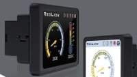
Lighting Technology
Wireless Software Suite
Tech Briefs
Brady BMP®61 Label Printer
Aerospace & Defense Tech Briefs
Data Recording and Playback System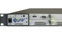
Robotics & Automation INSIDER
Product Focus: Olis Launches a Diagnostic Tool That Runs on Any Android Device
Aerospace & Defense Tech Briefs
In-Network Processing on Low-Cost IoT Nodes for Maritime Surveillance
Embedded Computing INSIDER
IoT Security Toolkit
Tech Briefs
Streaming Software Speeds Apps
Software Tech Briefs
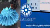
Mobile Multi-System Overview
Motion Control & Automation Technology
Linear Positioning Stages
Tech Briefs
Embedded System GUIs
Medical Design Briefs
First High Performance Bi-Directional Flow Sensor
Tech Briefs
How Programmable Switches Enable Smarter Display
Off-Highway Engineering
Danfoss Introduces Robust Telematics Platform
Medical Design Briefs
How Virtual, Cloud-Based Technologies Are Powering the Next Industrial Revolution
Tech Briefs
Product of The Month
Automotive Engineering
Data Acquisition and Control System
Software Tech Briefs
Space Images for NASA JPL Android Version
Medical Design Briefs
External and Embedded Modems
Motion Control & Automation Technology
Manufacturing Connectivity
Off-Highway Engineering
Multimedia Analyzer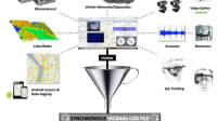
Imaging Technology
Human-Machine Interface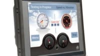
Tech Briefs
Tiny Embedded Device Server
Tech Briefs
Integrated Test and Operations System
Medical Design Briefs
Universal Code Reader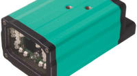

Top Stories
INSIDERManufacturing & Prototyping
![]() How Airbus is Using w-DED to 3D Print Larger Titanium Airplane Parts
How Airbus is Using w-DED to 3D Print Larger Titanium Airplane Parts
INSIDERManned Systems
![]() FAA to Replace Aging Network of Ground-Based Radars
FAA to Replace Aging Network of Ground-Based Radars
NewsTransportation
![]() CES 2026: Bosch is Ready to Bring AI to Your (Likely ICE-powered) Vehicle
CES 2026: Bosch is Ready to Bring AI to Your (Likely ICE-powered) Vehicle
NewsSoftware
![]() Accelerating Down the Road to Autonomy
Accelerating Down the Road to Autonomy
EditorialDesign
![]() DarkSky One Wants to Make the World a Darker Place
DarkSky One Wants to Make the World a Darker Place
INSIDERMaterials
![]() Can This Self-Healing Composite Make Airplane and Spacecraft Components Last...
Can This Self-Healing Composite Make Airplane and Spacecraft Components Last...
Webcasts
Defense
![]() How Sift's Unified Observability Platform Accelerates Drone Innovation
How Sift's Unified Observability Platform Accelerates Drone Innovation
Automotive
![]() E/E Architecture Redefined: Building Smarter, Safer, and Scalable...
E/E Architecture Redefined: Building Smarter, Safer, and Scalable...
Power
![]() Hydrogen Engines Are Heating Up for Heavy Duty
Hydrogen Engines Are Heating Up for Heavy Duty
Electronics & Computers
![]() Advantages of Smart Power Distribution Unit Design for Automotive...
Advantages of Smart Power Distribution Unit Design for Automotive...
Unmanned Systems
![]() Quiet, Please: NVH Improvement Opportunities in the Early Design...
Quiet, Please: NVH Improvement Opportunities in the Early Design...